Field and Command: Two Sides of Emergency Response
Palo Alto's AREDN mesh network supports two purpose-built applications for disaster response: ES-Link for field workers and the Situational Awareness (SA) server for Emergency Operations Center (EOC) commanders. Together, they provide a complete picture of what's happening on the ground — even when the internet, cellular networks, and commercial power are all down.
ES-Link: Eyes on the Ground
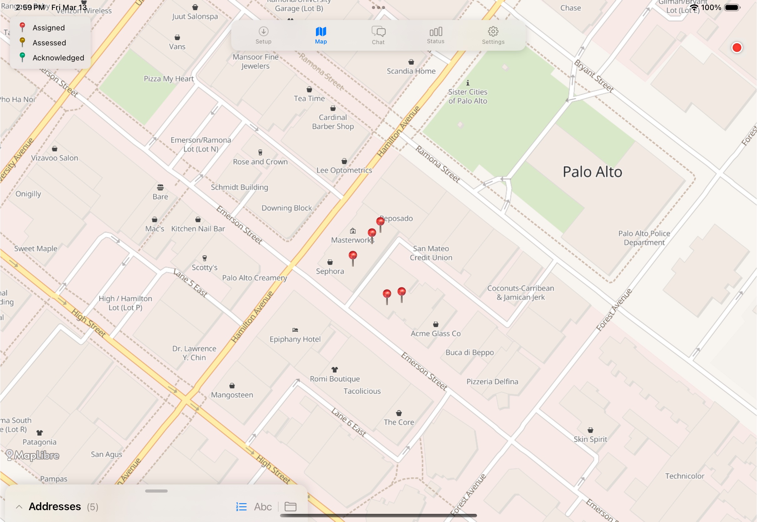
ES-Link is an iPad app carried by Emergency Service Volunteers (ESVs) as they go door-to-door after an earthquake or other disaster. Before heading into the field, the volunteer downloads their assigned neighborhood — including a complete offline vector map and address list — over the AREDN network.
In the field, ES-Link works entirely offline. The volunteer taps an address pin on the map, fills out a rapid damage assessment (structural damage, fires, trapped persons, utility hazards), and submits it. The assessment is compressed into a compact binary message and transmitted over a Meshtastic LoRa mesh radio — a small, low-power device that can relay data across miles without any infrastructure. When MQTT internet connectivity is available, ES-Link uses that path as well, automatically selecting the best available transport.
Each assessment is acknowledged end-to-end: the ES-Link app tracks whether the EOC has received and confirmed every submission, so the volunteer always knows their reports got through.
Situational Awareness: The Big Picture
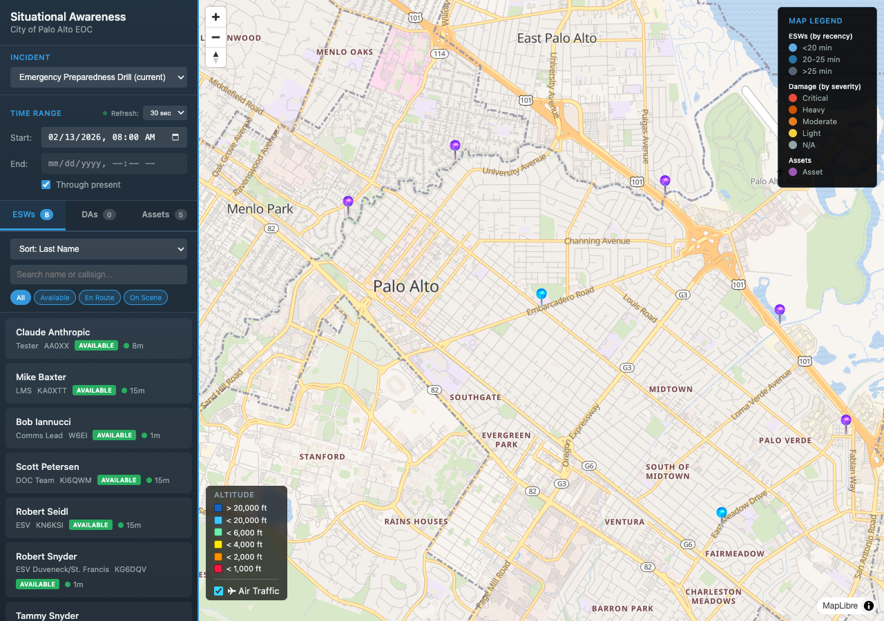
Back at the EOC, the Situational Awareness server aggregates everything onto a single map. Damage assessments appear as color-coded pins — from light damage to critical — as they arrive over the mesh network or MQTT. ESV positions are tracked in real time, so commanders can see who is in the field, where they are, and how recently they checked in.
The SA server also integrates ADS-B air traffic data, showing aircraft positions and altitudes over the area. This is valuable during disaster response when helicopter and fixed-wing operations are active. The interface provides filtering by time range, incident, and ESV status (Available, En Route, On Scene), giving commanders the tools to coordinate response dynamically.
Built for When Nothing Else Works
Both applications are designed around a core assumption: traditional communications will fail. The AREDN mesh network provides the backbone — solar and battery-powered nodes that create a resilient WiFi network across Palo Alto. Meshtastic radios extend reach to areas the mesh doesn't cover. And every component works offline-first, syncing when connectivity becomes available. No cell towers, no internet, no cloud services required.